
Approximately 100 miles of trails and 200 miles of scenic roads lead to some of the most wonderful spots at Land Between the Lakes National Recreation Area. Native wildlife, plants, and wildflowers thrive in our woods, fields, and lakeshores. Our trail system is extensive, offering a variety of excursion possibilities.
Please note: Class-1 E-Bikes can be operated on designated motorized routes including FS legal roads and bike trails. E-bike Notice 2026
- Trails are open year-round: come outside to play and experience the changing seasons!
- Check the Alerts page for additional info about trails
- Please use tick repellent spray before heading out in the woods.
Equestrian Trails
Wranglers Horse & Wagon Trails Map
Wranglers Trail 1
Trail 1: This 5.2-mile trail departs from “C” area. Riders follow the trail along the western edge of Fords Bay on Lake Barkley. This trail offers many scenic vistas and opportunities to view wildlife such as bald eagles, ospreys, waterfowl, and shorebirds.
Binoculars recommended.
Wranglers Trail 2
Trail 2: This short 2-mile loop trail provides beautiful late afternoon or early morning rides. It departs from “C” trail head. Watch for deer, turkey, and flowers.
Wranglers Trail 3
Trail 3: This 2.6-mile loop trail departs from “E” trail head and returns to camp in the back of “D” overflow. It too provides a great early morning or evening ride.
Wranglers Trail 4
Trail 4: This 3-mile trail begins in area “A” at the old tobacco barn. Horse enthusiasts enjoy this trail at night while riding under a full moon.
Tobacco Barn | FS Rd #353 Evidence of tobacco’s importance can be seen at this abandoned farm and homestead, south of Wranglers off Forest Service Road 172. This old tobacco barn has been standing for decades. Its solid construction barely shows the passage of time. Other structures nearby — an old chicken coop, shed, and the homestead itself — wear their age with grace and dignity.
Wranglers Trail 5
Trail 5: This 9.3-mile trail departs from “A” trail head by the old Tobacco Barn. On this trail, you will find natural springs, gentle rolling hills, and open fields.
Wranglers Trail 6
Trail 6: Departing from the day-use area, this 11.8-mile trail takes you to “Blue Hole.” Pack a lunch for a relaxing picnic by the creek — we provide picnic tables and tethering poles. You might want to also visit the block building, Laura Furnace, plus the historical marker and grave of The Little Drummer Boy.
Kindly tether your horses outside the cemetery when you pay your respects.
Blue Hole Laura Furnace Creek empties into Blue Hole, a deep spring rich in blue color for most of the year. Located on the south end of our horseback riding area, it’s a favorite spot for riders because of the peaceful scenery, cool water and close to many historic sites.
Please leave “slag” or “blue rocks” behind for others to enjoy. These artifacts date from the late 1800’s Iron Industry and are a protected resource.
Laura Furnace Iron ore production helped the area prosper during the mid-1800s. It also took its toll on the environment. On the eastern boundary of Wranglers, Laura Furnace Creek flows right by the site of the old Laura Furnace. Notice the blue slag covering the forest floor, a by-product of the smelting process. Up the hill, large stones are testament to the furnace structure, now long gone. Observe the uniform size of the meadow’s trees- all planted at the same time. Workers cut timber near iron furnaces for charcoal, the iron furnaces’ fuel supply. Laura Furnace ceased production in 1880, and the forest is still recovering from its overuse.
To learn more about the iron industry at Land Between the Lakes, visit the Center Iron Furnace or Great Western Iron Furnace’s display boards
Little Drummer Boy Historians believe Nathan Futrell to be the youngest drummer boy in the Revolutionary War at seven years old. The childhood adventures of this little American patriot have become the stuff of legends. By 1820, the North Carolina-born Futrell had settled right here on Fords Creek where he planted the area’s first apple orchard. He and his wife, Charity, are buried up a hill a mile or two beyond Wranglers Campground. The Daughters of the American Revolution erected a plaque in honor of Futrell’s war contributions.
Wranglers Trail 7
Trail 7: After going to the Blue Hole on Trail 6, you may want to continue on to Trail 7 to the tobacco barn. This 10.8-mile trail departs from area “C.” It follows along Forest Service Roads #174 and #353 before crossing Road #165.
Wranglers Trail 8
Trail 8: The longest trail in the system, this 19.3-mile trail departs from area “C” and is shared with hikers along portions of the North/South Trail. Several roads serve as part of the trail. At the halfway point, you may join up with Trail 12 and ride around the South Bison Range to take in the sights.
Wranglers Trail 9
Trail 9: This 8-mile trail departs from the Day Use Area and crosses Forest Service Road #165. Watch for the old chimney and natural spring near Bacon Creek Road.
Wranglers Trail 10
Trail 10: This 10.5-mile trail has become our riders favorite trail. It offers a wide variety of terrain. Ride along the edge of Lake Barkley and notice the homestead remnants.
Please do not disturb these remnants. Be careful and watch for old wells and cisterns.
Help us preserve our heritage.
Carvings and graffiti on trees and structures are unsightly and detrimental to timber and historical structures. Protect your public land.
Wranglers Trail 11
Trail 11: This trail was closed due to the expansion of US68/KY80. In 2017 we opened this 16-mile re-route with help from the local chapter of Backcountry Horsemen of America, contractors, Forest Service staff, and other volunteers.
Wranglers Trail 12
Trail 12: This 7.3-mile spur trail can take you around the South Bison Range, Great Western Furnace, and The Homeplace Farm Picnic Area. This spur requires back tracking to return to Wranglers Campground. Riders share the North/South Trail with hikers and bikers beginning at the southernmost point of Trail 8 near Kiosk E.
South Bison Range: Bison may look slow and docile, but can reach speeds of up to 35 mph. Do not taunt the bison. These bison can break through this fence. Use caution
Hiking and Biking Trails
Canal Loop Trail
This 11-mile loop has 4 connectors providing up to 14 miles of trail opportunities. One of our most popular mountain biking trails, the Canal Loop offers spectacular lake views, a variety of challenging terrain, and opportunities for short or long loops.
Central Hardwoods Scenic Trail
This trail provides users with smooth surfaces, gentle grades, and trailside rest areas. It runs parallel with US68/KY80 highways. The paved 2.5 miles on the eastern portion provides shoreline views of Lake Barkley and wildlife viewing opportunities in open areas. The 8.5 miles of the central and western portions use a compacted stone surface. Explore rolling hills and ridge tops of a central hardwoods forest ecosystem.
Energy Lake Trail
The Energy Lake Trail has a figure eight pattern that is a 4.6 mile loop. This offers the hiker and biker an opportunity to explore either the small and large loops or both. The trail meanders by parts of Energy lake and Lake Barkley providing the opportunity to view the various flora and fauna located at Land Between the Lakes. Look for bald eagles, osprey, beavers, summer songbirds, and wildflowers along the way.
Fort Henry Trail
Located in the south end of Land Between the Lakes, The Fort Henry Trail System connects 9 trails totaling approximately 27 miles. These trails follow the route of General Grant’s troop movements from Fort Henry to Fort Donelson during the Civil War. The Fort Henry trail system offers hikers/bikers some of the best opportunities for solitude at Land Between the Lakes.
CLOSURE: Portions of the Ft. Henry trail system were severely damaged during the December 10, 2021 tornadoes. As a result, Pickett Loop, Connector #1 (from Boswell Landing), and Connector #2 (from Ft. Henry Trailhead/FS Road 232) are closed until further notice as a safety precaution around ongoing and planned timber salvage operations. Ft. Henry Trailhead will remain open for visitor parking however this may change as salvage operations progress closer to the area.
Hillman Heritage National Recreation Trail
Check-in and register at Hillman Ferry Gatehouse
The 5.47 miles of trails within the Hillman Ferry Campground woods are listed as a Heritage National Recreation Trail for hiking and biking only. These trails follow historic roads used by the former Star Lime Works community disbanded during construction of the Kentucky Lake reservoir and dam.
The trails are open to Hillman campers as well as the general public for hiking and biking. There is a small parking lot on the north (right) side of the Hillman Ferry Campground entrance road, just before the gatehouse, for the general public.
North/South Trail – North End
This 59-mile trail spans the entire length of the recreation area. Terrain ranges from rugged, hilly areas in the north to easier, less strenuous hiking in the south. You can access sections of this trail from points along a variety of Forest Service roads and facilities.
The 31-mile North End of the trail is open to both biking and hiking.
Hiking Only Trails
Woodlands Nature Watch Trails
Our Woodlands Nature Watch Area offers optimum opportunities to see native wildlife at Land Between the Lakes. We manage the area to keep the forest healthy and to keep invasive species from taking control of our native landscape. We also plant crops to help native wildlife build habitats for healthy living and to hide from predators.
Hematite Trail
Encircling 80-acre Hematite Lake, this 2.2-mile loop trail is known for its high diversity of birds, reptiles, amphibians, and woodland wildflowers. The landscape is marked with scars of the iron industry. This forest patch hosts the closest to “old growth” forest in Land Between the Lakes National Recreation Area.
This trail also features a ¼ mile long wetland boardwalk. Canebrake and willow border the boardwalk, which allows the visitor to peer into a beaver marsh without a muddy foot or scraped knee. Look for spring cress in April, jewelweed and purple fringeless orchids in July, and the cardinal flower in September.
Long Creek Paved Trail – Wheelchair Accessible
Peek into the bottomland forest of Land Between the Lakes as this ¼ mile paved path leads you through sycamores, sweet gums, and oak stands. Kingfishers, green herons, and beaver inhabit these deep woods. This trail offers a great opportunity for children and other people looking for an easy walk.
Honker Lake and Trail
Honker Lake is a shallow, 180-acre impoundment that was originally built by the Civilian Conservation Corps in the 1930s for waterfowl management. Honker Lake has hosted several wildlife reintroductions, such as beaver, osprey, Canada geese, and otters.
The lake offers two great ways to view wildlife: hiking and paddling. A 4.6-mile hiking loop trail circles the lake, meandering through the lake shore, upland, and bottom-land forest settings. Kayaking and canoeing provide a different vantage point to wildlife in these calm waters. See lotus flowers blooming and watch osprey dive for fish and beavers slap the water with their paddle-like tails. Guided canoe and kayaks programs are offered seasonally through the Woodlands Nature Station.
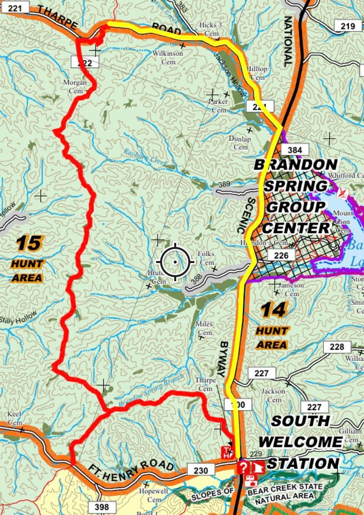
North/South Trail – South End
This 59-mile trail spans the entire length of the recreation area. Terrain ranges from rugged, hilly areas in the north to easier, less strenuous hiking in the south. You can access sections of this trail from points along a variety of Forest Service roads and facilities.
The 27-mile South End of this trail is hiker-only with a shared-use equestrian section between Road 342 and the Homeplace.
- DETOUR for North/South Trail- South End – A detour has been established to bypass a section of the North/South Trail that was impacted during the December 10, 2021 tornados. Approximately 7.9 miles of the North/South Trail and 0.80 miles of the North/South-Ft. Henry Connector will be closed until further notice between South Welcome Station and FS Roads 221, 222, and 230. Barricades are placed on the trail at these locations. The detour (approx. 6.4 miles) utilizes portions of the Woodlands Trace National Scenic Byway and FS Road 221 and will provide trail users extra clearance around ongoing and planned logging operations . Trail users should look for “detour” decals on white posts installed at intersections and follow the white diamonds between posts.
Turkey Bay Trails
Route Markers
All trails are two-directional.
Primary Trails | Yellow Blaze
Maintained trails offer novice riders pleasant, less-challenging riding opportunities.
Secondary Trails | Orange Blaze
Narrow, more challenging trails serve as connectors between primary trails.
Tertiary Trails | Blue Blaze
Narrowest, most challenging trails serve as connectors between both primary and secondary trails.
Challenge Areas | Red Rings
These are typically 2-10 acres of steep, washed-out hill climbs. Although individual trails within our Challenge Areas will not be marked, boundaries are marked by red rings on the trees. Only ride on trails already established.
Turkey Trot Youth Trail
A 1/2 mile kids’ riding and learning trail is available in the flat, wooded area near May’s Cemetery. The area is fenced off and incorporates many fundamental obstacles for beginning riders like small rocks and logs, sharp turns, uphill/downhill/side hill challenges, and whoop-dee-doo’s. Help build your child’s confidence; teach basic trail riding techniques on Turkey Trot Trail.
Turkey Trot Rules and Regulations:
- No camping in the kids’ riding area.
- Only riders 16 years or under are allowed.
- Helmets must be worn at all times. We recommend wearing protective safety gear such as gloves, boots, eye protection, and body armor.
- Direct supervision is mandatory at all times.
- We encourage parents or legal guardians to walk the trail with young riders.
- Only ATVs and dirt bikes 90cc or less are allowed on the trail. No go-carts.
- A Turkey Bay riding permit is required for all vehicles.
- Obey 10 mph speed limit. This trail is not a race track
- Trail traffic is ONE WAY. Stay on the marked trail and follow the arrows.
- No camping in the kids’ riding area.
Paddling Trails
Land Between the Lakes Regional Water Trails interactive map